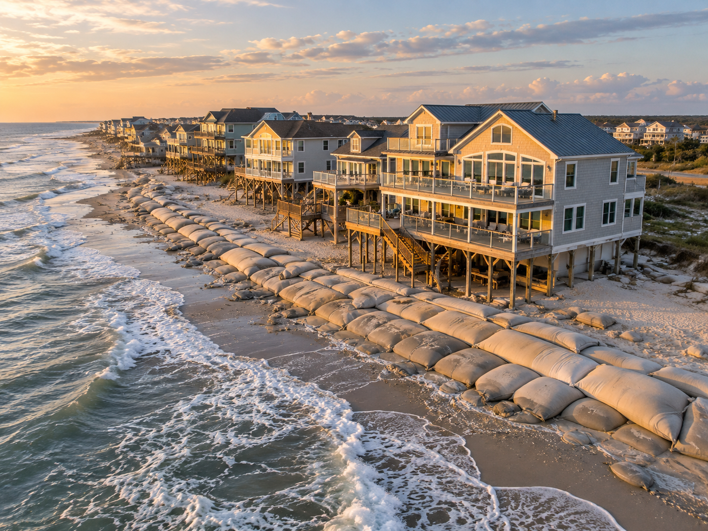
If you own property at North Topsail Beach, or you've been seriously looking there, you've probably noticed the sandbags. Hard to miss them, honestly. The north end near New River Inlet has been losing ground for decades, and the town has been trying everything from channel realignment to emergency sandbag walls to hold the line. Now there's a new development worth paying attention to: the U.S. Army Corps of Engineers released a draft Environmental Impact Statement) in September 2026 laying out five alternatives for managing erosion near the inlet, and North Topsail Beach has a clear favorite. The public comment period is open through October 19, 2026, so this is the moment to get informed.
Key Takeaways
The Army Corps of Engineers released a draft EIS in September 2026 with five alternatives for managing erosion near New River Inlet.
North Topsail Beach's preferred option combines a 2,021-foot terminal groin, regular beach nourishment, and active inlet management.
Projected 30-year costs run approximately $18 million, though that number can shift depending on nourishment frequency and future conditions.
This is still a draft proposal. Authorization, state permitting, and funding decisions all come later.
Some north-end parcels fall within CBRS Unit L06, where federal flood insurance is generally not available for new or substantially improved structures.
Erosion rates near New River Inlet have reached as high as 100 feet per year near some structures.
Written comments are accepted through October 19, 2026. Reference project number SAW-2016-02091.
What Is Proposed at New River Inlet?
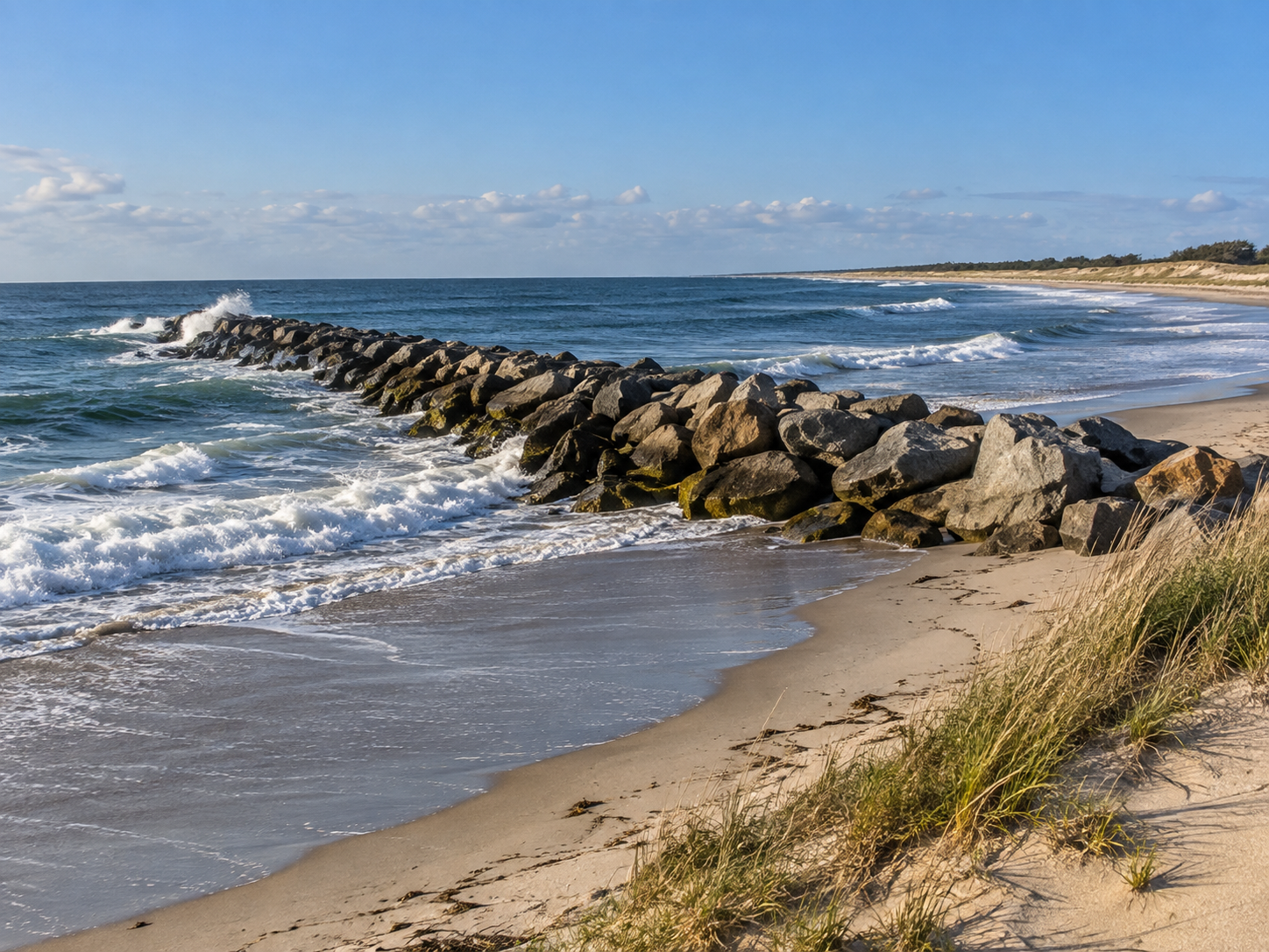
A terminal groin is a structure built perpendicular to the shoreline at the tip of a barrier island, right where it meets an inlet. It's designed to catch sand moving along the beach and slow the erosion that happens when an inlet keeps shifting. It's not a seawall, and it's not a jetty. Jetties are longer, come in pairs, and exist for navigation. A terminal groin is specifically about keeping sand on the beach side of the equation.
North Topsail's preferred plan, Alternative 5, combines three things working together:
Terminal groin: A structure just over 2,000 feet long placed on the south side of New River Inlet, using sheet piles and rubble sections.
Beach nourishment: Periodic sand placement on the beach and dune to restore width, estimated on roughly four-year cycles.
Inlet management: Active dredging and sediment coordination to influence how water and sand move through the inlet system.
The other four alternatives in the study include doing nothing, managed retreat, nourishment without a groin, and inlet management on its own. The Corps weighs all of them before any decision moves forward, regardless of what the town prefers.
Why Does the Proposal Matter to Buyers and Owners?
Here's what I think people miss when they hear about a proposal like this: it sounds like a solution, and it may become one, but it's a long way from a done deal. And even if it does move forward, the effects won't be felt uniformly across North Topsail Beach.
The north end near New River Inlet is where the problem is concentrated. Parts of that stretch have lost nearly 250 feet of shoreline since 1996. The 2013 channel realignment project placed over 560,000 cubic yards of sand on 1.5 miles of shoreline and bought some time, but the inlet hazard area eroded again fast. What followed was an emergency sandbag revetment that now covers roughly 3,600 feet of shoreline. At high tide near some structures, there's simply no beach.
Properties farther south on the island are in a genuinely different situation. Buyers sometimes treat North Topsail Beach as one uniform market, but the risk profile changes significantly depending on how close a property sits to the inlet. That distinction matters whether you're buying, selling, or just trying to understand what you already own.
Which Property Costs Deserve a Closer Look?
The draft EIS puts 30-year construction and maintenance costs at roughly $18 million. What that number doesn't tell you is how those costs would eventually be distributed, whether through town assessments, bonding, state grants, or some federal cost-sharing arrangement. Those decisions come later, and they're not settled yet.
A few things worth keeping on your radar:
State permit requirements: North Carolina law ties any terminal groin approval to a beach fill component, an inlet management plan, monitoring, and financial assurances. The groin can't be permitted in isolation.
Condo buyers: HOA reserves, past assessments, and future obligations deserve a close read. Beach access structures, dunes, and common areas can carry costs that aren't obvious from the listing.
CBRS parcels: Some north-end properties fall within Coastal Barrier Resources System Unit L06. In those areas, most new federal assistance, including federal flood insurance for new or substantially improved structures, is generally not available. This is a material fact, not a detail buried in the footnotes.
Flood insurance: North Topsail Beach participates in FEMA's Community Rating System, which can provides eligible policyholders a discount. But your actual premium depends on your specific property's flood zone, elevation, and underwriting. Get a real quote.
What Should Buyers Review Before an Offer?
Buying near an active inlet requires a longer checklist than most coastal purchases. Some of these items take time to pull together, so build that into your timeline.
Insurance quotes: Get them before going under contract, not after. Ask specifically about CBRS status, flood zone, elevation certificate, and prior claims on the property.
Elevation certificate: If one doesn't exist for the property, factor in the cost and time to get one.
Shoreline documentation: Pull current CAMA setback lines, erosion rate maps from the NC Division of Coastal Management, active permits, and any sandbag agreements tied to the parcel.
Current survey: Shorelines near inlets can shift more than most people expect. A recent survey matters here.
HOA financials: For condos and planned communities, the reserve study, budget, and meeting minutes often surface known issues before they become your problem.
Replacement feasibility: If the structure were lost to erosion or a major storm, could it be rebuilt under current regulations? This is worth a direct conversation with a coastal attorney or CAMA specialist before you close.
None of this is meant to talk anyone out of North Topsail Beach. It's a genuinely special place to own property. But near an active inlet, the due diligence is just more layered, and I'd rather buyers go in with eyes open than get surprised six months later.
What Should Owners Prepare Before a Sale?
If you're thinking about selling on the north end, preparation pays off. Buyers doing real due diligence will find the erosion history, the sandbag permits, and the inlet study. Getting ahead of those conversations is better for your listing than letting a buyer's agent surface them as concerns.
Start by pulling together what you have: permits, elevation certificates, surveys, insurance records, HOA documents, and any correspondence related to the terminal groin study or shoreline management. These aren't just nice to have. They build confidence with serious buyers.
On the marketing side, measured language matters more here than in most listings. Avoid language that promises protection, stable beach widths, or appreciation tied to an unapproved proposal. If your property sits away from the inlet hazard area, that's worth making clear. Buyers often paint all of North Topsail Beach with the same brush, and a well-positioned listing can correct that assumption instead of letting it work against you.
How Can the Public Comment Before October 19?
The in-person hearing took place September 22, 2026, at North Topsail Town Hall. If you missed it, written comments remain open through October 19, 2026.
Reference project number SAW-2016-02091 and submit through the USACE Regulatory Request System or by mail to the Wilmington District office. Comments grounded in specific observations, property-level detail, or requests for additional analysis tend to carry more weight than general statements. Everything submitted enters the public administrative record.
After the comment period closes, a Final EIS is expected around March 2027. Authorization and funding decisions follow after that, so there's still a long road ahead.
Check out this article next