Are you concerned about flooding and storm surge in the Greater Wilmington Area (New Hanover, Pender, and Brunswick Counties)?
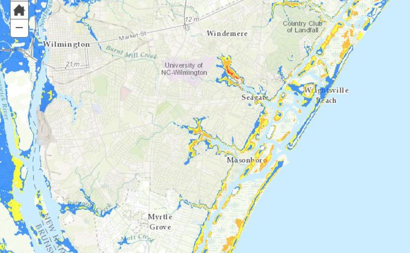
Recently, the National Hurricane Center released a map showing areas of potential storm surge in the United States. The map is organized by Hurricane Wind Categories and shows the worse-case flooding scenarios. The National Hurricane Center said around 22 million people are affected by storm surge, which accounts for half of all tropical storm related deaths. Not everyone realizes how far inland storm surge can reach and many underestimate what precautions they need to take when a storm rolls through.
We know how important it is to our clients to know if their home and community is located in an area that floods. Each property in southeastern North Carolina is labeled as being inside or outside of a flood zone, which also identifies how often the area usually floods. You can view this new map to get an idea of overall storm surge activity in the Greater Wilmington area (as well as other places up and down the east coast).
To use the map to view our area, you need to zoom in: there is no way to search by address. The map overlay disappears when you get to the street level, so this map is best used for a general understanding of storm surge in our area. You can only get a true understanding of how storms affect a specific street or community by looking for the information locally.
If you’re concerned about storm surge and flooding, your Realtor can help you find out what the case may be for individual properties. If you’re currently not working with an agent, give us a call at 910.202.2546 or send us a message through our Contact page and we’ll be happy to answer your questions.